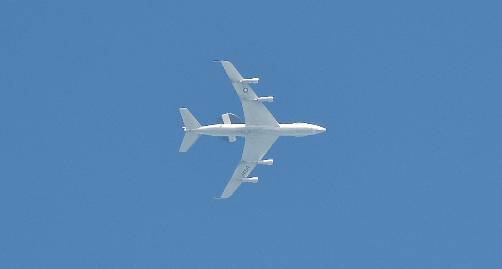
AWACS Over Fairhope
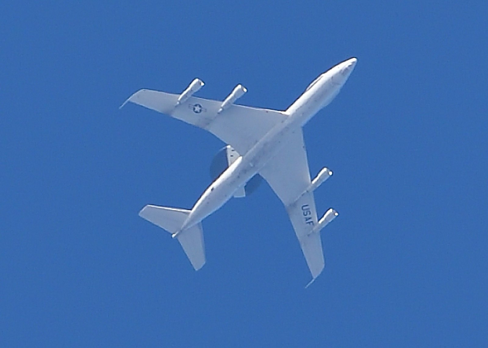
A US Air Force Boeing E-3 Sentry flies patterns over the eastern shore MAY 2nd 2025.
Flying at an altitude of 29,000 feet or about 5.5 miles, the aircraft moves at a ground speed of 400 knots or 460 mph. The aircraft had flown to the Gulf coast from Tinker Air Force Base in Oklahoma City. With its distinctive 30 foot diameter and six feet thick rotating radar dome mounted on top, the E-3 Sentry is known by many as AWACS, or Airborne Warning and Control System. With the radar’s ability to see over 250 miles away, AWACS aircraft provide valuable surveillance information about hostile activity in sensitive areas of conflict. The aircraft’s radar and computer systems can give military commanders detailed battlefield information, including tracking enemy aircraft and ships. Surveillance capability extends from the earth’s surface into the stratosphere, over land or water. Besides being sent to major command and control centers, information can also be shared with the President and Secretary of Defense. The radar is also equipped with technology that allows identifying friendly versus hostile aircraft. The Sentry is built on the same airframe as Boeing’s 707 commercial aircraft and has a range of almost 4,600 miles. The aircraft can stay in the air for over eight hours before needing refueling. AWACS crews serve in military “hot spots” worldwide. In fiscal 1998 constant dollars, the Sentry has a unit cost of around $270 million. Four crew members fly the aircraft, although the mission crew can include more than a dozen personnel, depending on requirements. Photo shot from Fairhope, roughly six miles below the aircraft…